Thursday, July 23, 2015

Jinzhou Travel Guide

Chinese Name: 锦州市 (jǐn zhōu shì)
Population: 3,071,000
Area: 10,300 square kilometers (3,977square miles) 
Nationalities: Han 
Administrative Division: 3 districts (Taihe, Guta, Linghe); 2 counties (Heishan, Yixian); 2 county-level cities (Linghai, Beizhen) 
Seat of the City Government: 68, Shifu Lu, Taihe District 
Useful Telephone Numbers: Tourist Complaints: 0416-3872060 
Weather Forecast: 121
Zip Code Inquiry: 184
Bank of China Jinzhou Branch: 25, fifth section of Jiefang Lu, Linghe District
China Post Jinzhou Branch: 4, fourth section of Yan'an Lu, Linghe District

Location: Located in the southwest of Liaoning Province, Jinzhou City neighbors Shenyang in the east and Huludao in the west. It reclines along the Songling Mountains in the north and is facing the Liaodong Bay of the Bohai Sea in the south. 

History: During the Spring and Autumn Period (770BC-476BC) and Warring Stated Period (476BC-221BC), this area belonged to the Yan Kingdom. In the Qin (221BC-206BC) and Han (206BC-220AD) dynasties, it was included in the shires, or tributaries, in present Liaoning. The name of Jinzhou was initiated in the Liao Dynasty (916-1125). 

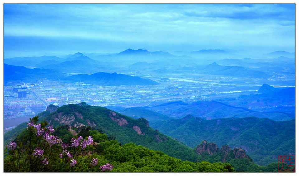
Physical Features: The terrain here is inclined from the northwest to the southeast. In the northwest and northeast of the city stand the Songling Mountains and Yiwulu Mountains. Southward to the coastal plain area, the average altitude drops to 20 meters (66 feet) or, even lower. 

Climate: The area enjoys a temperate, monsoon climate at middle latitudes. Differences in temperature vary greatly during the whole year. It has distinct four seasons with an average temperature of around 8-9 degrees centigrade (46.4-48.2 degrees Fahrenheit)

When to Go: Considering the weather, April to October is the golden season for a visit, while to see the fascinating snowscape and folk festivals, January to February is the best period for traveling. 

Special Local Products: dried bean curd, smoked chicken, Lingchuan White Wine, sea food of Bohai Bay

Local Highlights: Every year, many Buddhist along with unique folk activities will be held in the North Putuo Mountain (a sacred Buddhist mountain connected with the South Putuo Mountain in Zhejiang), attracting numerous travelers and pilgrims from near and far. 

Attractions

Wenya Museum (文雅博物馆; Wényǎbówùguǎn). Set up by the amateur collector Du Wenya, this museum houses an impressive collection of fossils found in the local region, some fossils having been found nowhere else. 

Bijia Mountain (笔架山; Bǐjiàshān), (30 min S of Jinzhou). Connects to the mainland via an isthmus at low tide and is more of a big hill than a mountain. There are numerous small Buddha temples on the hill and vendors selling various souvenirs and snacks. Is well worth the trip. If you have the time, take a boat out to the hill, walk around for several hours visiting the temples, and then walk on the land bridge back to shore when low tide comes. 

Guta Park (古塔公园; Gǔtǎgōngyuán). A quiet park in the south eastern part of the city featuring the Guangji Pagoda. The 72 m (236 ft) tower is a beautiful Liao style pagoda, with thirteen levels in an octagonal shape. 

For more information, please visit www.top-chinatour.com

Liaoyang Travel Guide

Chinese Name: 辽阳市 (liáo yáng shì)
Population: 1,810,000 
Area: 4,741 square kilometers (1,831 square miles) 
Nationalities: Han 
Administrative Divisions: Five districts (Baita, Wensheng, Hongwei, Gongchangling, Taizihe); one county (Liaoyang); one county-level city (Dengta) 
Seat of the City Government: 38, Minzhu Lu, Baita District
Useful Telephone Numbers: Tourist Complaints: 0419-2127132
Weather Forecast: 121
Zip Code Inquiry: 184

Location: Situated in the centre of Liaoning Province, Liaoyang city is bordered by the 'steel capital', Anshan, in the south and 'the city of coal and iron', Benxi, in the east. Shenyang, the capital city of the province, is just 60 kilometers (37 miles) away in the north. 

History: Liaoyang is the oldest city of Liaoning Province, with an administrative history of more than two thousand years. It was first known as Xiangping, and had been a leading city in eastern Liaoning during the Western Han Dynasty (206BC-24AD). The name, Liaoyang, initially appeared in the late Tang Dynasty (618-907).         

Physical Features: Located between the low mountainous region of eastern Liaoning and the Liaohe Plain, the city slopes downward from the southeast to the northwest. Low mountains and hills are distributed mainly in the east of the city.

Climate: Most of the city is situated in the temperate monsoon climatic zone, with its western region enjoying a warm temperate semi-humid monsoon climate. With a coastal influence, Liaoyang has four distinct seasons, and comparatively humid and moderate weather. Spring is warm and dry, and summer is torrid and rainy. After the cool and humid autumn, comes the long and chilly winter. 

When to Go: spring and autumn

Special Local Products: Nanguo Pear, Xiangshui Pear, hawthorn, Chinese gooseberry, wild grape

Attractions

White Pagoda Park (白塔公园; Báitǎgōngyuán), 60 Zhonghua Road (中华大街一段60号; Zhōnghuádàjiēyīduàn) (From the train station take bus 7), ☎ +86 419 2126429. This is the tallest, at 70.4 metres, ancient pagoda in the Northeast of China. It dates to the Liao Dynasty and is one of the 6 oldest pagoda towers in China. The park was constructed around the pagoda in 1908. Free.

Guangyou Temple Scenic Area (广佑寺风景区; Guǎngyòusìfēngjǐngqū). Constructed during the Eastern Han Dynasty, this is one of the oldest Buddhist sites in China. In the year 1161, the site received favour of the Emperor and was expanded. In the early 1900's, the army of the old Tsarist Russia burned the site. It has since been restored. This temple complex covers some 60,000 square metres. Within lies a large statue of Sakyamuni Buddha made of camphor wood and gilded with gold. It is the largest, by volume, statue of Sakyamuni Buddha in camphor wood in the world and stands some 21.48 meters high. Free.

Longfeng Mountain Scenic Spot and Temple (龙峰寺风景区; Lóngfēngsìfēngjǐngqū), Xiadahe Town (About about 35 kilometers form Liaoyang City centre). Longfeng temple dates to the time of the Tang Dynasty Emperor Zhenguan, over 1,300 years ago. It was renovated during the Ming and Qing dynasties. According to inscriptions in the temple, Tang Emperor Taizong visited the site as did the Emperor Qianlong of Qing in the 44th year of his rule. The temple was damaged during the Cultural Revolution of the 20th century. It has since been restored. 

Liaoyang City Museum (辽阳市博物馆; Liáoyángshì Bówùguǎn), 2 Zongxin Road, Wensheng District (文圣区中心路2号; Wénshèngqū Zhōngxīnlù) (Form the train station take bus 23 or 16), ☎ +86 419 3232297, +86 1330 4198145. This museum opend in 1985 and in 2002 was graded as a AA class site by the Provincial Tourism Bureau. The museum covers 31,450 square meters over five galleries and contains 4,000 items form the neolithic through to Ming and Qing dynasties. This site is closed for renovation until at least October 2008. The new Lioayang City Museum is located adjacent to the old museum and was opened in 2009. 

Cao Xueqin Memorial Hall (曹雪芹纪念馆; Cáoxuěqín Jìniànguǎn), 2 Woshi Hutong (卧狮胡同2号; Wòshīhútòng) (Take bus 20. It is just 100 metres from the Wang Erlie Memorial Hall), ☎ +86 419 2138074. "The Dream of Red Mansions" is one of the four most famous novels of China. It was written by Cao Xueqin. Over the years, there has been much debate as to where Cao Xueqin was born. Liaoyang has been put forward as the likely location. In 1995, a Memorial to Cao Xueqin was opened in Liaoyang. Free.

Wang Erlie Memorial Hall (王尔烈纪念馆; Wángěrlièjìniànguǎn), Baita District (Take bus 20. It is just 100 metres from the Cao Xue Memorial Hall). Wang Erlie was a court official born in Liaoyang during the rein of the Emperor Qianlong. He achieved excelent scores in his Imperial exams and subsequently had a career that saw him become one of the richest and most powerful people in China. The museum tells the story of his life and has some English language translations. Free.

Dongjing City (东京城; Dōngjīngchéng), Taizihe District (太子河区; Tàizǐhéqū). Liaoyang became the capital city of the Manchurian Late Jin Empire in 1621. An imperial palace was built here called Dongjing or "East Capital" and covers and area of 0.75 square kilometres. A few walls and gates remain of the old palace.

Dongjing Mausoleum (东京陵; Dōngjīnglíng), Taizihe District (太子河区; Tàizǐhéqū). Build by the first Manchurian Emperor, Nurhachu, in 1624, to house the remains of his grandfather, wife, brother, son and others. In total ten people of Nurhachu's family were placed here. edit

Guanyin Temple (观音寺; Guānyīnsì). 

Qingfeng Temple (清风寺; Qīngfēngsì). 

Yanzhou Town (燕州城; Yānzhōuchéng). 

Li Zhaolin House (李兆麟故居; Lǐzhàolíngùjū). 

Liaoyang Forest of Steles (辽阳碑林; Liáoyángbēilín). 

Gusao Town (姑嫂城; Gūsǎochéng).

For more information, please visit www.top-chinatour.com

Monday, July 20, 2015

Baita (White Pagoda) Park

First established in 1908, Baita Park in Zhonghua Street is comprised of four tourist zones: for historic relics, a children's park, and zones for flower and animal appreciation respectively. The park’s name comes from a pagoda called Baita which stands there. The White Pagoda (Baita) standing in the park was built in the Liao Dynasty (916-1125) and is one of the six highest pagodas in China.
Baita Pagoda is the tallest, at 70.4 metres, ancient pagoda in the Northeast of China. It dates to 1189 in the Liao Dynasty with additions during Yuan and Ming, making this one of the 6 oldest pagoda towers in China. This pagoda tower was, on January 13, 1988, approved by the State Council, as a national-level heritage conservation unit.
Baita park, which surrounds the pagoda, is a pleasant city park. Entrance is free and its location just 500 metres from the train station makes it a convenient place for a walk. The pagoda stands roughly in the centre of the park. It is surrounded by four turtle statues. The pagoda itself is made of solid brick and so cannot be climbed. It has eight sides, with a statue of the Buddha on each. Towards the back of the park is the Thousand Buddha Temple. This temple is free to enter and contains many statues of Bodhisattvas as well as a thousand small statues of Buddha. Beside the park is the Guangyou temple though this requires an entrance ticket
For more information, please visit www.top-chinatour.com

Yongling Mausoleum

The Qing Dynasty had 12 emperors, of whom 10 ruled from Beijing. All the emperors had their own massive tombs built in Zunhua and Yixian of Hebei Province, except for the last emperor, Puyi. As the two mausoleum areas are located east and west of Beijing, they are called “East Mausoleums of the Qing Dynasty” and “West Mausoleums of the Qing Dynasty.” 
Before the Qing made Beijing its capital, three mausoleums were built, namely, the Yongling Mausoleum for ancestors of the Qing imperial family, the Fuling Mausoleum for Nurhachi, and the Zhaoling Mausoleum for Huangtaiji, collectively known as “Three Imperial Mausoleums of Early Qing Dynasty” or the “Three Mausoleums North of the Great Wall.” The three mausoleums have all been listed as world heritage sites by the 28th World Heritage Commission on July 1, 2004. 
The Yongling Mausoleum is located in the town of Yongling, Xinbin Manchu Autonomous County, Liaoning Province. Buried in the mausoleum are the remote ancestor, great grandfather, grandfather, father, uncles, and the wives of Nurhachi, Emperor Taizu of the Qing Dynasty. 
The mausoleum, which is surrounded by walls, consists of the front yard, Square City and Treasure City. At the center of the front yard is a red gate facing four pavilions lined up in a row. In the pavilions are the memorial steles, which record the life stories of the four ancestors. North of the pavilions is the Square City with the main hall, the Qiyun Hall, inside. The hall has single eaves, yellow glass tiles, four gates and eight windows.There are four larger enclosed heated spaces with beds and four smaller enclosed heated spaces within the palace. Two divine tablets are located in each of the enclosed spaces, with eight seats and four sacrifice tables in front. In the east and west wings of Qiyun Hall are side halls; in front of the west side hall is a stove for burning silk.Located behind Qiyun Palace is Treasure City with mausoleums in the east and west. The Yongling Mausoleum has no underground hall.
For more information, please visit www.top-chinatour.com

Sunday, July 19, 2015

Hetuala City

Hetuala is Manchu language for Henggang, meaning flat headed hummock. Hetuala City is located in Yongling Town of Xinbin Manchu Autonomous County in Liaoning Province. It was the very first capital city of the Late Jin Dynasty as well as the last mountain city in Chinese history, moreover, it is the best-preserved Manchu city until now. Hetuala, the center of politics, economy, military, culture and diplomacy of Late Jin, was famed as the birthplace of Qing Dynasty and the cradle of the thrift of Manchuria. It has great value in the study of history, art, society and culture.
History
Constructed in 1603, Hetuala City is an ancient city of 400 years. In 1616, the first day of the 44th ruling year of Ming dynasty according to Chinese lunar calendar, Nurhaci ascent the throne and established Late Jin Dynasty. The 8th year of Tiancong, it was addressed by Hungtaiji, a later emperor, as the favor of God. This city becomes well-known not only because it is the birthplace of Nurhaci, the forefather of Qing dynasty, but because it used to be the capital of the number one powerful empire.
Hetuala City is divided into an inner city and an outside city. In the north of the inner city situates the heart of the whole city—Han Gong Da Ya Men, the certain place for Nurhaci to ascend the throne in 1616. The layout of the room is full of the royal atmosphere. There are two ponds sit on both sides of the palace named the eyes of the dragon.
The middle of the inner city is basin-liked and the only drinking water well named Hanwang Well is here. In the southwest of the city locates Pujue Temple, also known as Guandi Temple. It has vivid sculptures and paintings inside the temple. Every April 18th of Chinese lunar calendar when the temple fair is held, people from different cities come here to pray and play. 

Royal Temples
Head north out of the city, you'll see the solemn and grand royal temples—Dizang Temple and Xianyou Palace. Dizang Temple is the earliest temple built by Manchu people, it was and is the resort of Buddhism, and you can always smell the fragrance of incense and hear the sound of bells. Xianyou Palace was the place for Nurhaci to pray when he got into a war or important events happened. There is a 400 years old elm in the place which is still full of energy.
Hetuala City is neighbored by Shenyang, Tieling, Jilin, Dandong, Benxi and etc which make it very convenient to travel around. The scenic spot has beautiful landscape and has everything you need when travel. Plus, you can enjoy Manchu style song and dance performance whenever you come. There’s a Manchu Folk-Custom Garden which holds religion activities, and a custom museum showing people’s life style in the past. 
Tips:
-You could take coach at North or South Railway Station of Shenyang, go along Shenfu Highway and line 202 to get to scenic area directly. 
- Give yourself at least two or three hours. 
-It has a lot of special local product like ginseng, pilose antler and mushroom. 
-You can taste Manchu specialty "Ba Die Ba Wan"( eight dishes and eight bowls of food). 
For more information, please visit www.top-chinatour.com

Fenghuang (Phoenix) Mountain

Fenghuang Mountain is a mountain located in Fengcheng, Dandong City, Liaoning Province. Its highest peak is called Jianyan with a height of 836 meters above sea level. Fenhuang Mountain is one of Liaoning Provinces's four famous mountains, the other three being Qianshan, Yiwulü Mountain and Yao Mountain. It features different fascinating sceneries in different seasons. Temples, stone inscriptions and many other humanistic relics surrounded by emerald mountains make up an exquisite piece of landscape painting. 

As early as the Daoguang Period of the Qing Dynasty, Fenghuang Mountain along with Yiwu Lu Mountain, Qian Mountain and Yao Mountain were regarded as the four famed mountains in Liaoning Province. It was called “the most famed mountain in east Liaoning” in ancient times, and is reputed as “a famed mountain that can be regarded as the window of the nation”, “the most famed mountain of the Great Wall” as well as “the most famed mountain for adventure in China.” In January 1994, it was approved as a key state-level tourist spot by the State Council.
Fenghuang Mountain was once named “Wugu Mountain”, “Heng Mountain”, “Wu Mountain” and “Xiong Mountain”. Then in the Zhenguan Period of the Tang Dynasty, Emperor Taizong of Tang - Li Shimin conferred the name “Fenghuang Mountain” on it. Fenghuang Mountain is part of Changbai Mountain. The highest peak – Zanyun Peak – is at an elevation of 836.4 meters. It is renowned all around north Liaoning province for its majestic and steep cliffs, deep and remote caves, bizarre plants as well as its picturesque scenery in all four seasons.
Fenghuang Mountain is separated into four scenic areas, namely, West Mountain, East Mountain, Temple Valley and Ancient City. The main one is Xi Mountain Scenic Area, where Zanyun Peak rises amidst breathtaking scenery such as “Back of the Ox” and “Wonder in the world.” Remote caves, such as “Fenghuang Cave” and “Tongxuan Cave” also dot the area along with amazing landscapes like “Sea of Clouds” and “Flowing Stream and Pouring Fall.” 
The East Mountain Scenic Area is a fantastic place to be close to the nature. At present, there are artificial landscapes including tourist steps, sightseeing pavilions, sightseeing bridges and a lake. The Ancient City consists of Wugu City of the Southern and Northern Dynasties, Xiongshan City of the Sui and Tang Dynasties along with Sanyang City of the Liao Dynasty. The existing structures are mainly palaces and temples, among which Ziyang Temple, Doumu Palace, Kwan-yin Pavilion, Bixia Palace and Yaowang Temple are the most famous. The Ancient City is a state-level key cultural relic conservation unit.
The traditional Yaowang Temple Fair is held on the 28th day of the 4th lunar month every year. It lasts for four days and the temple area will be full of people.
For more information, please visit www.top-chinatour.com

Thursday, July 16, 2015

Dalu (Big Deer Island)

Dalu (Big Deer) Island lies in Dagushan Town of Donggang City. It is a vital fortress and port on the sea, and a beautiful island for tourists. The Sino-Japanese War (1894-1895) broke out on the sea around the island, left tourists endless meditation for the past. This island is also rich in sea product and boasts natural bathing beaches. While having a pleasant time in the soft beach, visitors can also please their palate. 

The island has beautiful scenery and a pleasant climate, with seaside resorts, and a wide variety of seafood, such as shrimp, crabs, conch, short-necked clams, other clams, and all sorts of fish, a veritable delight for gourmets.

It is also investing heavily in construction work and tourism infrastructure and is becoming a popular choice for tourists, especially for its natural landscape, including Erlang Rock, the Gaba jujube tree, Dishui Lake, Tiger Cave, Camel Peak, Deng Shichang's tomb, the Mao Wenlong stele, Sea Goddess Temple, the British-style lighthouse, and the Danish church ruins.
Moon Bay and Twin-pearl Beach to the front of the island have the biggest natural outdoor bathing spot in the North Sea and are an ideal place for tourists to pick up seashells, go fishing, surf, watch the sunrise, or just listen to the waves.
There are free buses from the ferry wharf over the mountain to the island's main beach, although they are driven by maniacs. Once at the beach, tourists can rent bicycles and golf carts to drive around the waterfront, although the whole area is very walkable. Locals seem to prefer death by motorcycle. Take a bike ride or walk around the island, find and eat shellfish off the rocks and in the sand during the right season, fish, swim in summer.
Tips: The easiest way to get there by public transport is by taking a bus from Dandong's long distance bus station (located opposite Dandong Railway Station). A two-hour bus to Gushan will cost 17.50 Yuan (May 2013) and travelers to Dalu Island should get off a stop earlier at Huangtukan where a local can take drive you the next few kilometres to the new ferry terminal. A group of four of us were charged 10 Yuan per person, which may be negotiable. Ferries in the off season run irregularly, there is one at 4pm in the afternoon which may be the only and last one. A ticket costs 60 Yuan, but speedboats also go to and from the island charging up to 90 Yuan. The ferry takes less than 30 minutes.
For more information, please visit www.top-chinatour.com

Wednesday, July 15, 2015

Benxi Water Cave

Located in the Taizi river bank which is 26 kilometers away from the eastern suburb of Benxi city, Liaoning Province, Benxi Water Cave is a huge cave system located at the Taizi River. It is a part of the Benxi Water Cave National Park. It is the longest underground river in the world that can be visited by boat, which has ever been discovered in the world. As Benxi Cave is a river cave, most of the cave visit is done by boat. At the cave entrance is an underground wharf where the visitors enter the boats. The pier is rather big and up to 40 boats are berthed here. 
Benxi Water Cave dates back nearly five million years, and is recognized as one of the treasures of Northern China. The cave covers an area of 36,000 square kilometers (9 acres) and stretches inward 2,800 meters (3063 yards). Entering the semi-lunar mouth of the cave, one finds the 'guest-greeting hall' which is said to have been inhabited by human settlers three thousand years ago. The waterways and the pavilions outside complement the cave perfectly, making this both a scenic and a historic destination. Water Cave lies 35 kilometers (22 miles) east of downtown, on the side of the Taizi River. 
It is divided into two caves, a water one and a dry one. The entrance to the cave is face to the North and back on to the South. It is 16 meters high and 25 meters wide, to be a half-moon shape. It is the biggest entrance to the cave in the whole country. There are four hand-written words “Benxi Water Cave” which written by Bo Yibo on the top. The Water Cave is 5800 meters long, 2800 meters of which has been developed. The total area is 36,000 square meters and the total space is 400,000 cubic meters. 
The widest point of this water cave is 38 meter high and 50 meters wide, with the fresh floating air and the never exhausted clear river inside the cave. Day and night flow is 14,000 tons, with average water depth is 1.5 meters, deepest point is 7 meters, the constant temperature inside is 12 ℃. You can visit it all the year round. On the top and two sides of the river are various shapes of stalactites. Along the river are more than 100 scenic spots , It is called the silver river with nine twists because of divided into “Three Gorges”, ”Seven Palaces" and ” Nine Twists”. It is as a fairyland when you visit it by boat.
For more information, please visit www.top-chinatour.com

Monday, July 13, 2015

Jade Buddha Garden

Jade Buddha Garden scenic spot, which lies in north downtown of Anshang city, has a total area of 40,000 square meters. Surrounded by mountains and water, with a beautiful landscape area on its back, Jade Buddha Garden is to the opposite side of the big natural laughing buddha. It’s definitely one of the wonders among Chinese modern tourism history. Jade Buddha Garden comprises varieties of characteristic sceneries like Jade Buddha Attic, Yudai Bridge, three-hole Mountain Gate, Lotus Pond, Huaguo Island. All these spots lie against each other, together they make the perfect whole.
This scenic spot is built in the 1990s in order to preserve the largest jade Buddha in the world. The 7.95-meter-high (26-foot-high) Buddha is engraved from the Jade King of 261 tons that discovered in Xiuyan Man Autonomous County. The Jade Buddha Pavilion is the grandest building in the garden with a height of 33 meters (108 feet), with Jade Buddha is stored in it.
Best tourist season for Anshan is summer and autumn. Anshan lies at the edge of southeast Songliao Plain. Located at middle latitude, Anshan has a temperate continental monsoon climate which contains distinct seansons, rainy-hot period, dry-cold times, abundant precipitation, preferential temperature, rich sunshine and ever-happened catastrophic climate like storm, cyclone, hailstone, etc. Spring here is windy, with small precipitation, long sunlight duration, easy evaporation, low humidity; summer is rainy, rainstorms happen mostly during this high-temperatured but rarely broiling season; autumn is clear, with dropping percipitation and temperature; winter is dry and old, with more north wind and less snow.
Tips:
1.There’re many marketplaces (like Xinya Mansion, Guotai Mansion,etc), large shopping center s(like Da Runfa, Xin Yijia,etc) and professional markets at all bus stops of Anshang. Large mount of brands and ultra low price would startle you. But please note, low price, low quality.
2.With rich cultural deposits of food, delicacies around China gathered here, cuisines of Chuan, Yue, Liao, Lu and others are all well developed to cater for every tourist. The most recommended local food should be Haicheng Pie which dates back to the late Qing Dynasty.
For more information, please visit www.top-chinatour.com

Sunday, July 12, 2015

Lushun Port (Port Arthur)

Port Lushun is located at the south end of Liaodong Peninsula, facing the Huanghai Sea to the east and the Bohai Sea to the west, about 24 kilometer south to Dalian downtown. It is a well-known tourist attraction because of the close relationship with Chinese and Asian history.
History
In Tang Dynasty (618- 907), it was called Shizikou (Lion’s Mouth) because the geographic importance on the road connecting the whole nation. The name was changed into “Lushun” during Ming Dynasty (1368-1644), representing a wish for "smooth trip". Due to its strategic military importance, Qing government built naval port, battery and dock, and set up Northern Navy to guard it. Known as Port Arthur in western world, it was devastated by wars, among which the Sino-Japanese War and the Japanese-Russian War are the most significant two. Both Russia and Japan built lots of military sites in Lushun, making it known as an "open air museum of historical and cultural scenery."
Main Scenic Spots
Rich in natural resources as well as its historical heritage, Lushun has become a National Key Scenic Spot, National Nature Protection Area, and National Forest Park by virtue of its now famous attractions. These fall into two categories namely, the natural scenery and historical sites relating to the Sino-Japanese War in 1894-1895.

The Garden of Lions and Tigers

Covering an area of more than 300,000 square meters, it has three separate sections: the garden of tigers, of lions and of bears. The animals roam freely in their respective surroundings so that visitors, from the safety of their cars, can get quite close to them and enjoy a harmonious and breath-taking experience.


The Island of Snakes
This is a small island covering less than 2 square kilometers (0.77 square mile), off the northwest coast of Lushun, and is the home to over 1, 5000 snakes. Exotic rocks, luxuriant forests and plants provide their natural environment, where they prey on migratory birds for food. In Lushun, there is a snake museum which in addition to exhibits is home to relevant research. This is the prime Snake Eco-museum in Asia, and its hundreds of viper specimens ensure plenty of excitement for visitors. Also, the Snake-Island Natural History Museum is also well worth seeing.
The Bird Station

Opposite the Island of Snakes stands a volcano called 'Laotie Hill', which is a stopping off spot for millions of migratory birds that come there each spring and autumn. It is possible to see more than 200 species of birds preparing for flight to and from warm lands in the south depending upon the time of year. On the sea ward side of the hill there are steep towering crags. Stepping on the Century-Year Beacon, you can look over the boundary between the Bohai Sea and Yellow Sea, where the water is half yellow and half blue. Near the hill, there are important Neolithic sites.


Russo-Japanese War Site on East Crest Hill
East Crest Hill (Jiguan Hill) was a battlefield during Russo-Japanese War in 1904. It was here that the Russian army established a strong fortress after Lushun became a territory leased to Russia 1898. As the main feature on the hill, it houses the Cultural Relic Protection Unit as well as being the patriotism education base in Dalian. A museum was built in 1997 to display historical materials of the war.

Lushun Museum
Originally built in 1917, the world-class museum covers an area of 25,000 square meters (29,900 square yards) and is of a stately, elegant European style. Over 100,000 cultural relics are displayed in two themes: historical cultural relics and local cultural relics. Among them, there are bronzes, ancient coins, paintings and calligraphies, mummies, and some foreign relics.
White Jade Hill

A 130-meter-high (427-foot-high) hill standing in the center of Lushun Region is the central scenic spot. The name 'white jade' was given by Li Hongzhang, an influential official of Qing Dynasty (1644-1911). Ascending the hill and knowing the opposite one was called Gold Hill, he said gold should be associated with white jade. Thus the name it was changed to the present one. Using forced Chinese labor, the Japanese raised a tower on the crest of the hill to commemorate Japanese soldiers who died in the war. The tower has a height of 66.8 meters (219 feet) has become the evidence of their historical crime. The Park of White Jade Hill includes the Naval Weapon Museum, Bird Garden and Rock Museum.

World Peace Park
This seashore park was completed in 2002 with a theme of psalms by world heads of states. In 1998, they each wrote a poem in their mother tongue praying for world peace. These people included the past Chinese President Jiang Zemin and American President Clinton. The bronze statues of 96 heads of state and their poems are carved as the major feature. There are also artworks and fine stamps with the theme of peace presented by world countries.

Cemetery of Soviet Martyrs
With an area of 48,000 square meters (57,409.4 square yards), the cemetery ranks as the largest for a foreign nation in China. Here lie buried Soviet martyrs who fell during the war of Liberation of Northeast of China and the War against US Aggression in support of Korea, as well as those died in the Lushun garrison in 1945-1955. The cemetery is in the Soviet style of construction.
Memorial of Myriad Loyalists

This memorial was set up to commemorate the Chinese people who died in the Sino-Japanese War of 1894. Upon their invasion of Lushun and for four whole days Japanese forces slaughtered nearly 20,000 unarmed common people of the city! Only 36 persons remained alive. To hide all evidence of their guilt, the Japanese ordered local peasants to collect the bodies for cremation. The ashes of the victims were buried at the eastern foot of White Jade Hill. In 1896, after the Japanese retreat, corps of the Qing Dynasty built the Stele of Myriad Loyalists. It is listed as one of the National Patriotism Education Demonstration Bases.

For more information, please visit www.top-chinatour.com

Saturday, July 11, 2015

Red Beach

Red Beach, located in Dawa County, Panjin, Liaoning province,is famous for its landscape featuring the red plant of Chenopodiaceae, Suaeda salsa. Set in the Red Beach and broad reed field, is a wonderful scenic wetland tourist resort area. Furthermore, wooden buildings in archaic style bring more elegance to the scenic area.
The Sueda species is one of the few species of grass that can live in highly alkaline soil. Its growth cycle starts in April when it is colored light red, while the color of the mature species is deep red. Panjin Shuangtaizi River mouth state-level nature protection area preserves the most completed ecosystem and the biggestwetland in the world. The largest reed marsh in Asia is also located here, attracting many tourists. The reeds are used to make paper. The Red-crowned Crane also reproduces here and it is also the endangered black-mouth gull's largest breeding area.
The reeds and marsh here are the habitat of 236 kinds of birds. The most famous is the red-crowned cranes and Saunder's gull. Observing the cranes, gulls and other rare birds in the reeds sea is a tourism activity that is full of strong natural appeal. In this area, there is crane-observing platform.
In order to keep the whole ecosystem safe, the area was granted state-level protection back in 1988. Even though most of the Red Beach is closed to the public, there still is a small section that’s open for tourists. We can assure you that the photos below are not an example of infrared photography, it’s just one of those places that are hard to believe really exist!
For more information, please visit www.top-chinatour.com

Bijia Mountain Scenic Spot

Bijia Mountain is situated on the coast of the Bohai Sea adjacent to Jinzhou Port. Bijia Mountain Island and Tian Qiao are the key scenic spots in the mountain resort. The total area of the spot is 8 square kilometers, among which the land area of the scenic spot is 4.72 square kilometers. The mountain has three peaks, one is higher and the others are lower, it gets the name for it shapes like a pen rack (in Chinese we call it bijia). Tian Qiao, the sky bridge, dodges in and out of the water as the tide changes, so the mountain is sometimes called Tianqiao Mountain .
The mountain has many cultural relics and historic sites. It is said to be the place of the Pangu's Creation of the world and there are many pavilions and towers on it. Sanqing Pavilion is the most famous one and is a 'must go' spot. It is a completely stone-made but wooden-like six stories building without a single nail standing at the top of the mountain, from which visitors can have an overlook of the beautiful, vast sea. There are about 50 lifelike and vivid statues of the Buddha and Taoist and Confucian saints in the pavilion. On the top floor there is a shrine to the God of the Creation— Pangu. It is the only one of its kind in China.
During most times of the day, Bijia Mountain can only be accessed by boat. But when the sea recedes, a natural zigzagging cobblestone causeway, over 10 metres wide, links the island to the mainland and that is Tian Qiao, or Tian Lu(Sky road). The Sky Bridge is exactly a 1,620-meter-long (1772-yard-long) sand and pebble road between the island and the seashore, which dodges in and out of the water as the tide changes. It's a very rare attraction which appeals a lot of peolpe to visit here. Its legend has some similarity with the story in a part of Exodus about Moses parted Red Sea.
For more information, please visit www.top-chinatour.com

Friday, July 10, 2015

Bingyu Valley Scenic Area

Binyu Valley Scenic Area is acclaimed as the “Oriental Miniature Switzerland”. Located at the southern part of Liaotung Peninsula, 40 km away from downtown Dalian, it occupies an area of 170 square km. Unique lava landforms, natural pinewood and deep valleys are rare sights that can be found in this region. These vistas present rugged cliffs, astonishing peaks, and clear rivers wending their way through luxuriant virgin forests. This fascinating area, full of ecological significance, truly deserves its reputation as one of best-kept secrets of China.
The Bingyu Valley Scenic Area consists of the Longhua Mountain, the Xiaoyu (small) Valley and the Yingna River. The mountain gives visitors a sense of both loftiness and elegance, imbuing the visitor with both boldness and tranquility. Among the numerous scattered peaks you can discern many phantasms and figures, such as a gnarling tiger, a tiercel spreading its wings, or a long sharp sword.
The Yingna River, dances along the valley like a white silk ribbon. It is very calm in some sections of the valley, later becomes agitated, and even then changes into a picturesque lake. Its tributaries, looking like threads, twist around small isolated peaks. At the Shuanglong Dam, the scenery is suggestive of the captivating scenery of Guilin and the Three Gorges which is a most marvelous section of the Yangtze River. A lot of activities such as, skating (winter only), boating and fishing can only be enjoyed here.
The forest coverage rate of Bingyu Valley Scenic Area is more than 90% and the green primitive forests are here and there, owning the ability to clipse the sky. It is said that the primitive forest is a natural zone and a natural botanical garden. There are not only alpine and frigid region plants but also subtropical plants in the 1740 hectares primitive forest. The woody plants are more than 150 species and the herbaceous plants are more than 500 species. Some precious plants with high appreciation value and research value are also grown in the primitive forests. It is also a habitat for hundreds of animals and the vertebrate is more than 200 species, such as otters, roe deer, badgers, foxes, squirrels, and birds, especially indigenous robins.
For more information, please visit www.top-chinatour.com